o v e r l o o k s, p i c n i c g r o u n d s, c a m p i n g, l o d g i n g,
& i n f o r m a t i o n c e n t e r s
The following are all listed in order of mile markers along Skyline Drive, and a small way onto the Blue Ridge Parkway.
This is to help you find a place to stay, the nearest entrance station, a spot for your ceremony, places for photos, picnics, etc.
Please keep in mind that the growth changes seasonally. While some areas look mowed and flat in these photos, they could be overgrown and change quickly. Always check out the location again within a month before your ceremony. If you aren’t able to go and look at a location, I’d be happy to check it out for you.
Some areas are spacious and easy to access for some - so if one of your family members has a problem with their knees or a fear of heights, please keep that in mind when you location scout! This section is to help you make your list and give you ideas of what each spot can look like when photographed as you explore.
Most of these are overlooks! Meaning they can potentially be busy with traffic and lookers. They’re not as busy as other National Parks, but during busy season (September and October) they can get crowded - the rest of the year it’s relatively quiet with little to no people.
Front Royal (North) Entrance Station
mile marker 0
Nearby Towns :
Front Royal
Dickey Ridge Visitor Center : Mile Marker 4.5
Sunset Side
↓
sunset mountain views
spacious “yard” for running around, stretching your legs
scattered benches with a pretty view
souvenir shop
toilets


separate entrance, but also accessible from the Wayside Store*
Dickey Ridge Picnic Area : Mile Marker 4.5
Sunset Side
↓


Signal Knob Overlook : Mile Marker 5.5
Sunset Side
↓


Gooney Manor Overlook : Mile Marker 7.2
Sunset Side
↓


Wooded Pull-Off : Mile Marker 8.0
Sunset Side
↓


Indian Run Overlook : Mile Marker 10.5
Sunrise Side
↓


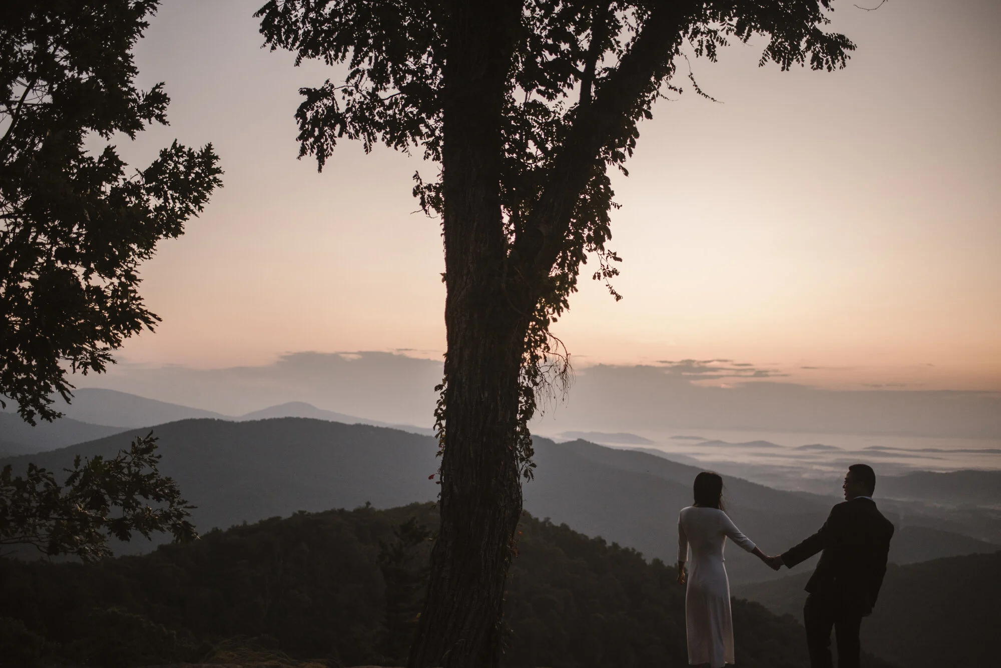
Rangeview Overlook : Mile Marker 17.0
Sunrise Side
↓
Beautiful at sunrise and sunset


Gimlet Ridge Overlook : Mile Marker 18.5
Sunset Side
↓
Steep, short hike down to rocks with an amazing view


Mount Marshall Overlook : Mile Marker 19.0
Sunrise Side
↓

Rattlesnake Point Overlook : Mile Marker 21.0
Sunrise
↓


Mathews Arm Campground : Mile Marker 22.0
Sunset
↓


separate entrance, but also accessible from the Wayside Store*
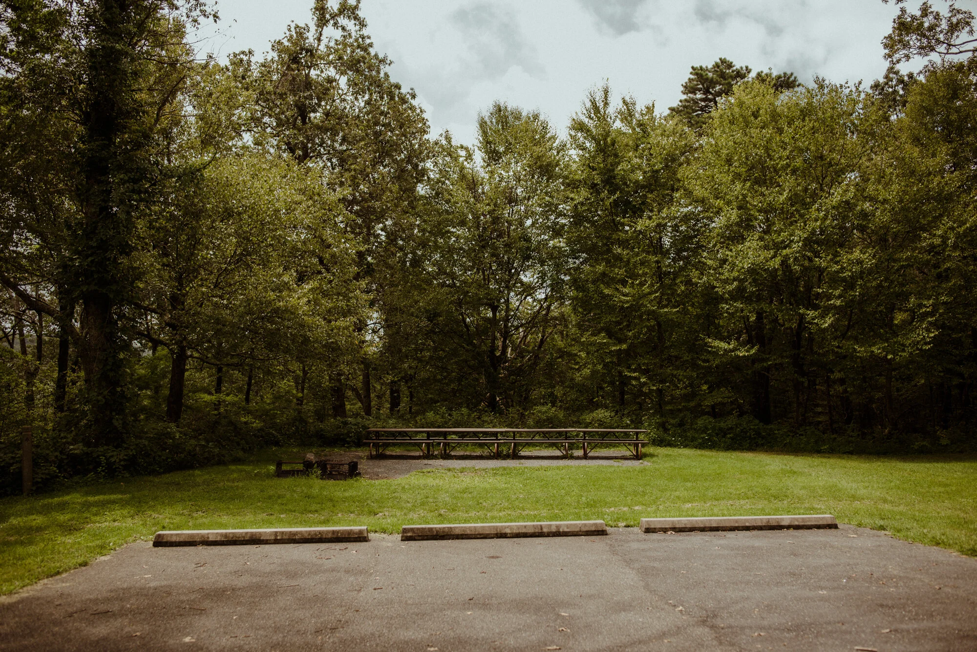
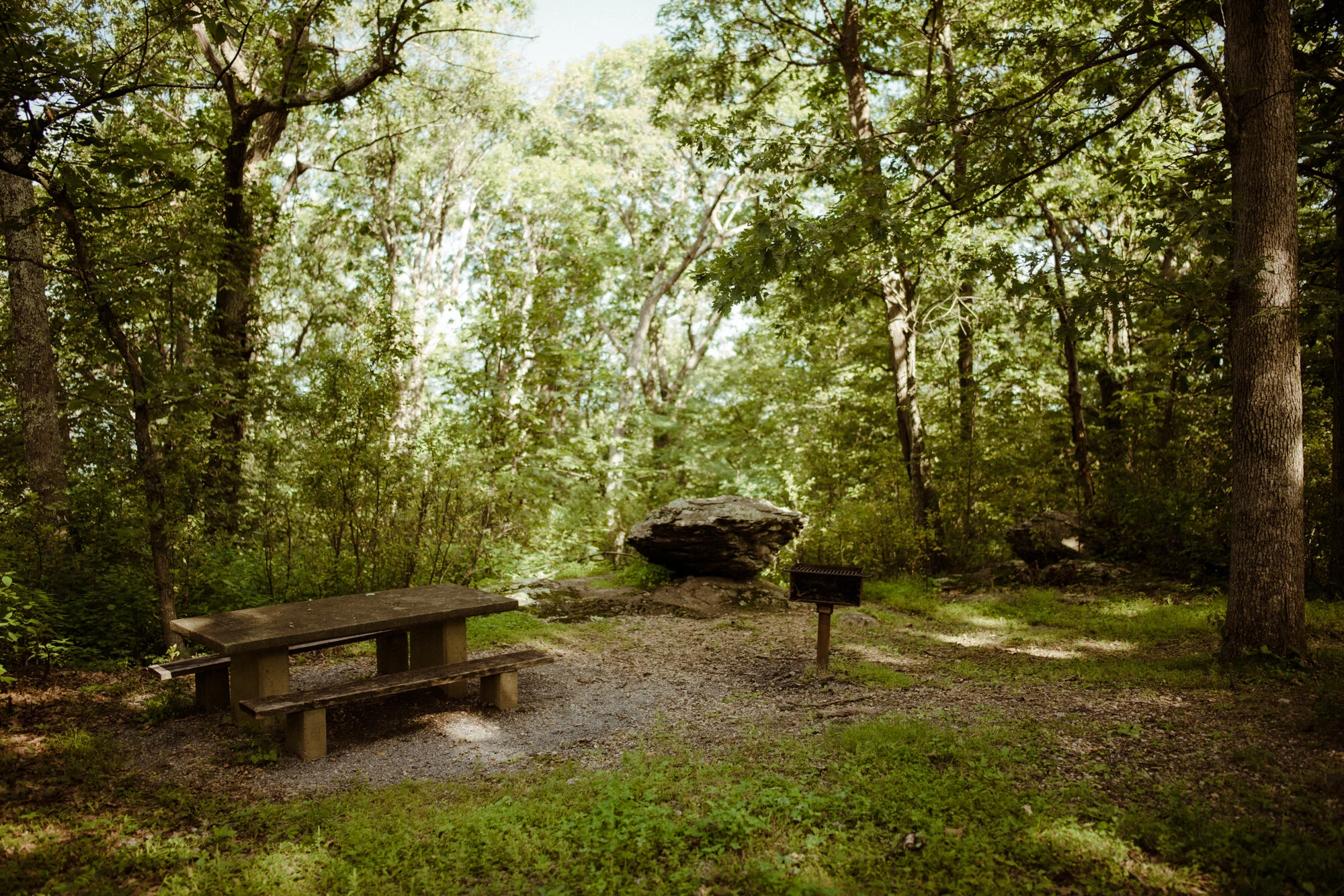
Elkwallow Picnic Grounds : Mile Marker 24.0
Sunset Side
↓
Large, spacious picnic area with multiple places to set up (fire pits, picnic tables, etc.)
Pit toilet, but near the Elkwallow Wayside Store where there are more bathrooms
Large forest, flat areas, plenty of parking, and small trails
Would make for a gorgeous ceremony, picnic / reception spot in the trees, especially for a bigger crowd
Very Easy to Access for Grandparents


Pass Mountain Overlook : Mile Marker 30.0
Sunset Side
↓
Mountain and Valley View
Forest, Flat Area
Best for a larger ceremony
Very Easy to Access for Grandparents


Thornton Gap Entrance Station
mile marker 30
Nearby Towns :
Luray, Sperryville
Tunnel Parking Overlook : Mile Marker 32.5
Sunrise Side
↓
Mountain View
Mary’s Rock Tunnel
Directly on the road with a small pull-off
Easy to Access for Grandparents
(by staying on the sidewalk / parking lot)
Buck Hollow Overlook : Mile Marker 32.8
Sunrise Side
↓
Mountain View
Some rocks by climbing over the stone wall
Best for a Ceremony of two
Not Easy to Access for Grandparents
(unless they stayed on the sidewalk / parking lot
or sat on the wall)


Hazel Mountain Overlook : Mile Marker 33
Sunrise Side
↓
Mountain View
Rocks
Best for a Ceremony of two
Not Easy to Access for Grandparents
(unless they stayed on the sidewalk / parking lot)


Pinnacles Overlook : Mile Marker 35
Sunrise Side
↓
Mountain View
Best for a Ceremony of two
Easy to Access for Grandparents
(staying on the sidewalk / parking lot)


Jewell Hollow Overlook : Mile Marker 36.5
Sunset Side
↓
Spacious
Mountain and Valley View
Rocks
Wooded / Forest Area
Flat Area for Plenty of Guests
Easy to access for Grandparents


Pinnacles Picnic Ground : Mile Marker 36.7
Sunset Side
Perfect backup spot in case of rain, or a small “reception” spot for a picnic.
↓
Pretty light during sunset
In a dense wooded area
Covered eating area
Picnic Tables
Pit toilets


Stony Man Mountain Overlook : Mile Marker 38.5
Sunset Side
↓
More Information Coming Soon


Thorofare Mountain Overlook : Mile Marker 40.5
Sunrise Side
↓
Spacious, when mowed
Mountain Peak View
Flat Area for Plenty of Guests
Moderate access for Grandparents
please check it out before deciding to see if all of your guests can access this spot.
It has a small stone wall to climb over and a tiny downhill to the flat area.
It also gets overgrown a lot, so see if it’s been mowed.


Skyland Lodging : Mile Marker 42
Sunset Side
↓
Lodging, Information Center, Bathrooms, Restaurant, Bar, Stony Man Trailhead, Conference Center for receptions
Timber Hollow Overlook : Mile Marker 43
Sunset Side
↓
Spacious enough for a few guests depending on the height of the grass
Mountain and Valley View
Rocks
Easy to access for Grandparents
no spot for seating, though


Crescent Rock Overlook : Mile Marker 44
Sunset Side
↓
Spacious enough for a few guests or best for only 2
Mountain and Valley View
Rocks
Wooded / Forest Area
Easy to access for Grandparents
no spot for seating, though


Old Rag View Overlook : Mile Marker 46.5
Sunrise Side
↓
first three photos are at sunrise in summer
second three photos are at sunset in winter
Spacious
Mountain Peak View
Flat Area for Plenty of Guests
Moderate access for Grandparents
please check it out before deciding to see if all of your guests can access this spot.
It has a tiny downhill to the flat area.


Spitler Knoll Overlook : Mile Marker 48
Sunrise Side
↓
Spacious, when mowed
Mountain and Valley View
Flat Area for Plenty of Guests
Not easy to access for Grandparents, unless they stay on the sidewalk above
please check it out before deciding to see if all of your guests can access this spot.
It has a small stone wall to climb over and a downhill to the flat area.


Big Meadows : Mile Marker 51
Sunrise and Sunset Side
↓
Spacious, when mowed
Some Mountain Views
Wooded / Forest Area
Flat Area for Plenty of Guests
Very easy access for Grandparents


Tanners Ridge : Mile Marker 51.5
Sunset Side
↓
Spacious, when mowed
Some Mountain Views
Wooded / Forest Area
Flat Area for Plenty of Guests
Very easy access for Grandparents


The Point Overlook : Mile Marker 55
Sunset
↓
Mountain and Valley View
Best for 2, or a few guests
Wooded / Forest Area
Moderate access for Grandparents
please check it out before deciding to see if all of your guests can access this spot.
It has a small trail downhill to the large rock area
Rocky, no spot for chairs


South River Picnic Area : Mile Marker 63.0
Sunrise
↓
Pictures Coming Soon
Swift Run Gap Entrance Station
mile marker 65.7
Nearby Towns :
Elkton, McGaheysville, Harrisonburg, Stanardsville
Bacon Hollow Overlook : Mile Marker 69
Sunrise Side


Loft Mountain Overlook : Mile Marker 74.5
Sunrise Side
Ivy Creek Overlook : Mile Marker 77.5
Sunrise Side
Rockytop Overlook : Mile Marker 78
Sunset Side


Loft Mountain Wayside Store & Souvenirs : Mile Marker 79
Groceries
Local Beer & Wine
Souvenirs
Loft Mountain Campground : Mile Marker 80
Sunrise Side
Amphitheatre (overlooking sunset) - camp store, showers, laundry, camping $15 per night

Big Run Overlook : Mile Marker 81
Sunset Side


Dundo Picnic Grounds : Mile Marker 85
compost restrooms, no camping, dumpster, recycling

Turk Mountain Overlook : Mile Marker 93.5
Sunset Side


Beagle Gap Parking : Mile Marker 99.5
Sunrise Side
NOT BEAGLE GAP OVERLOOK


Rockfish Gap Entrance Station
mile marker 104
Nearby Towns :
Waynesboro, Staunton, Afton
Blue Ridge Parkway Begins
Humpback Picnic Area : Blue Ridge Mile Marker 8


Greenstone Trail (no sign from the road): Blue Ridge Mile Marker 8.5
Sunset


Humpback Trail Parking : Blue Ridge Mile Marker 10
Sunrise Side
One Picnic Table


Ravens Roost Overlook : Blue Ridge Mile Marker 10.7
One Picnic Table